Milepost 422.4
Distance: 1.0 mile out and back from the parking area.
Difficulty: Strenuous
Elevation Gain : 258 feet Trailhead: Blue Ridge Parkway milepost 422.4, park at the Devil’s Courthouse Overlook
Elevation: 5720′
Tips:
This is a family friendly hike for children over 5. It is a very steep incline for adults.
Sneakers or hiking shoes
Definitely bring a camera or video camcorder the views are like a painting.
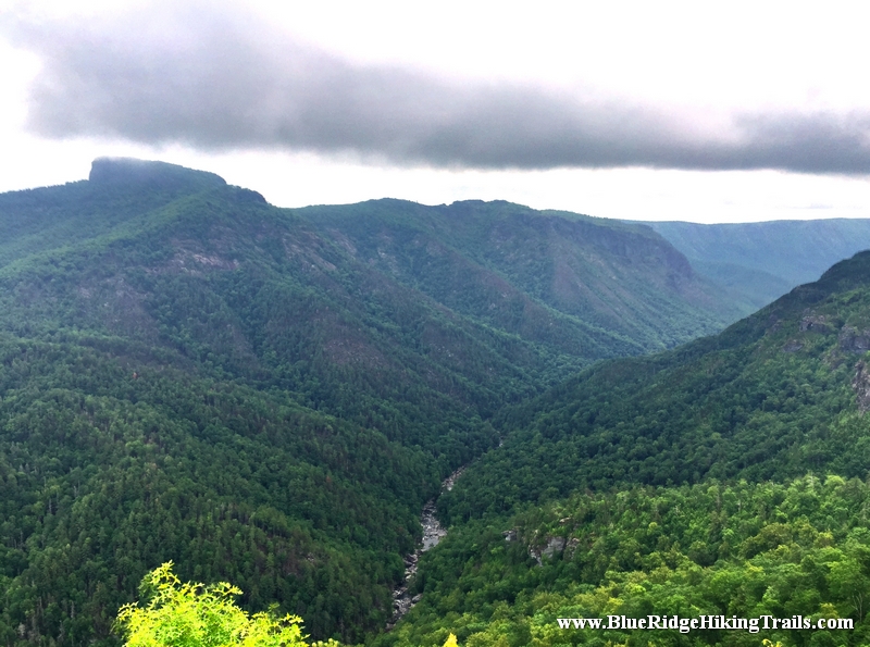
Park you car at the overlook. When looking up at the rock face sometimes you can see some tiny hikers at the top viewing area. Follow the paved pathway parallel with the Blue Ridge Parkway towards the tunnel and enter the woods. Get ready to climb almost straight up at a very steep incline. There is a bench in the left half way up. Then the pathway turns to a wall enclosed viewing area with spectacular mountain views. Looking to the East is the Carolina Piedmont. The view to the West is the Shining Rock Wilderness
Hiking Humpback Rocks is a relatively short hike following a 2.0-mile (3.2 km) trail loop. With a roughly 45-minute hike to ascend 740 feet (230 m) to the peak, and a 20-25-minute descent, this ranks as one of the shorter hikes along the Blue Ridge, however it remains one of the most rewarding. The peak affords a spectacular 360-degree view of the surrounding terrain. To the north you can see into the southern section of Shenandoah National Park, to the east check out the patchwork of farms, to the southwest you see thick woods and mountain ridges of the George Washington National Forest.
Hikers may continue to follow the Trail for .5 miles (0.80 km), passing along the top of a cliff with views to the south and east before descending 1.2 miles (1.9 km) to a blue blaze trail. This trail leads .3 miles (0.48 km) into the Humpback Rocks Picnic Area. The distance between Humpback Gap and the Humpback Rocks Picnic Area is 3.6 miles (5.8 km). A map of the hike and of the Humpback Gap Overlook is available through the Blue Ridge Parkway website.
Continuing past Humpback Rocks itself, the summit of Humpback Mountain is only a few minutes further. The Appalachian Trail is only a short hike to the north, at milepost 6.
The Humpback Rocks Visitors Center is located at milepost 5.8, six miles south of the Rockfish Gap Interchange of I-64 and US 250. It is most easily accessed by either one of these two highways. Head south on the Blue Ridge Parkway for 5.8 miles (9.3 km) to reach the Humpback Rocks Visitors Center, or continue another 0.2 miles (0.32 km) to arrive at the Humpback Gap parking area on the left.
The Appalachian Trail can also be accessed from the Humpback Gap parking area. Southbound hikers can reach it by continuing south on the Humpback Rocks trail. Northbound hikers can reach it taking the one mile (1.6 km) blue blazed path at the northern end of the parking lot, or the one mile (1.6 km) white blazed path just off of the Howardsville Turnpike.
Overview: This is a very family walking trail in Blowing Rock North Carolina. It is part of the Moses Cone Memorial Park Trail system. The hike is about one mile in length but is a beautiful walk around the lake during any season. This hiking trail is a great stretch your legs type of hike after you have been driving in the car all day. Pets are welcomed on this trail but must be on a leash. I would definitely recommend this hike during the fall season for a brisk walk and great picture taking.
Tips:
Make sure you have comfortable hiking shoes
You must sign your name to the Grandfather Mountain List for the Ranger
Bring plenty of water at least 2 bottles and a back pack
Bass Lake Loop Trail Map
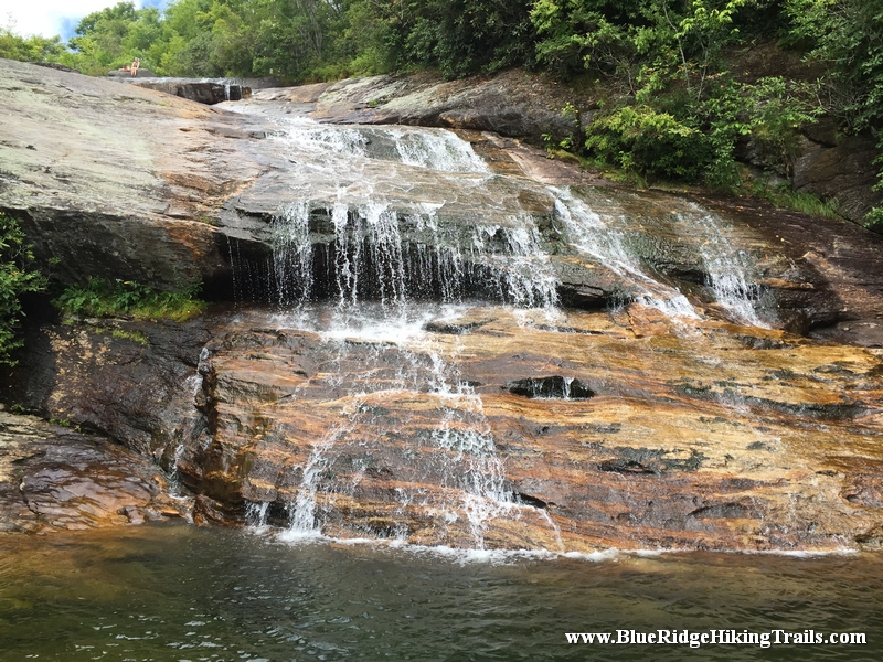
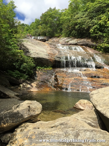
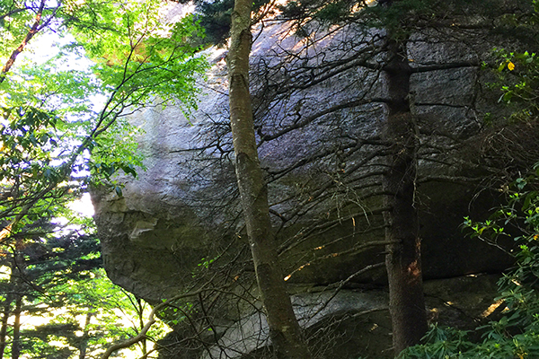
Photo Gallery
*Click on thumbnails for larger viewing and slideshow
Video View From Flat Rock View on Grandfather Mountain