by admin | Feb 19, 2014 | Easy Hiking Trails, Hiking By Activity, Hiking By Difficulty, Hiking Trails - Under 1.0 Mile, North Carolina Overlook Mountain Trails, North Carolina State Park Trails, North Carolina Waterfall Trails, Overlook Hiking Trails, State Park Hiking Trails, Waterfall Hiking Trails
Trail head: Millbrook Estates, North Carolina
Distance: 0.01 miles
Duration: 1 minute
Skill Level: Easy
Overview:
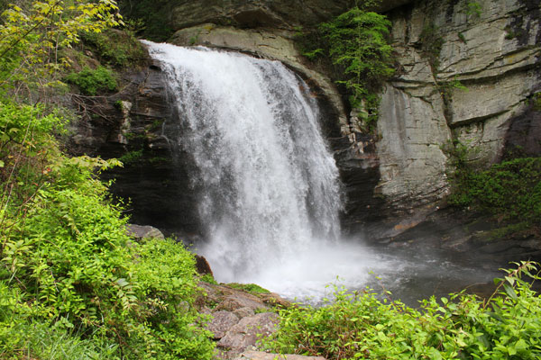
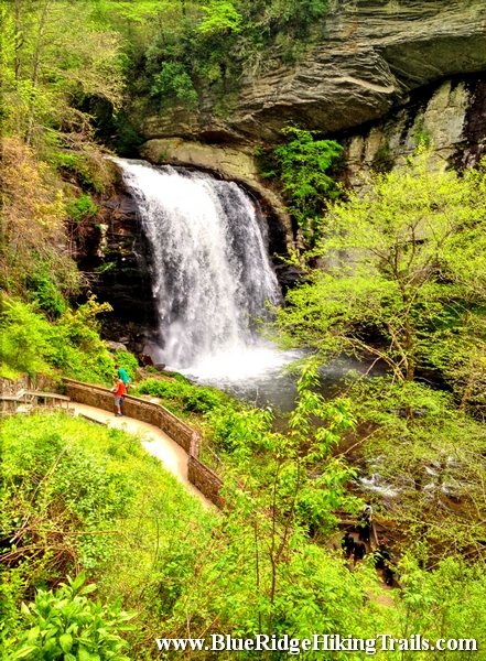
On your way to Brevard North Carolina on highway 64 there is an intersection whereabouts you take a left to Brevard on route 276 or to go into the Pisgah Forest. Go straight at the light and follow 276 North. Follow the Davidson River on the left hand side and go a 5.6 miles. At the fork in the road stay right and Looking Glass Falls is up on the right hand side.Looking Glass Falls is in the Pisgah Forest and open to the public year round. This waterfall is one of the more popular falls due to the visibility from the road.The waterfall has one drop and is 60 feet tall. There is a step path that takes you to the bottom and the plunge pool where many people take pictures and video. Its also kid friendly, accessible by wheelchair at the upper view, and swimming is allowed at the base of the pool. Looking Glass Falls is a great motorcycle waterfall to ride up to take some memorable photos and move onto the next waterfall down the same road route 276.
- Kid Friendly
- Upper View wheelchair access
- Steps to the bottom
- Swim at your own risk
- Visible from the road
Photo Gallery
*Click on thumbnails for larger viewing and slideshow
by admin | Feb 18, 2014 | Easy/Moderate Hiking Trails, Hiking By Difficulty, Hiking By Distance, Hiking Trails - Over 1.0 Mile, North Carolina State Park Trails, State Park Hiking Trails
Trail head: West Jefferson, North Carolina
Distance: 1.7 miles
Duration: 1 hour
Skill Level: Easy/Moderate Hiking Trails
Overview:
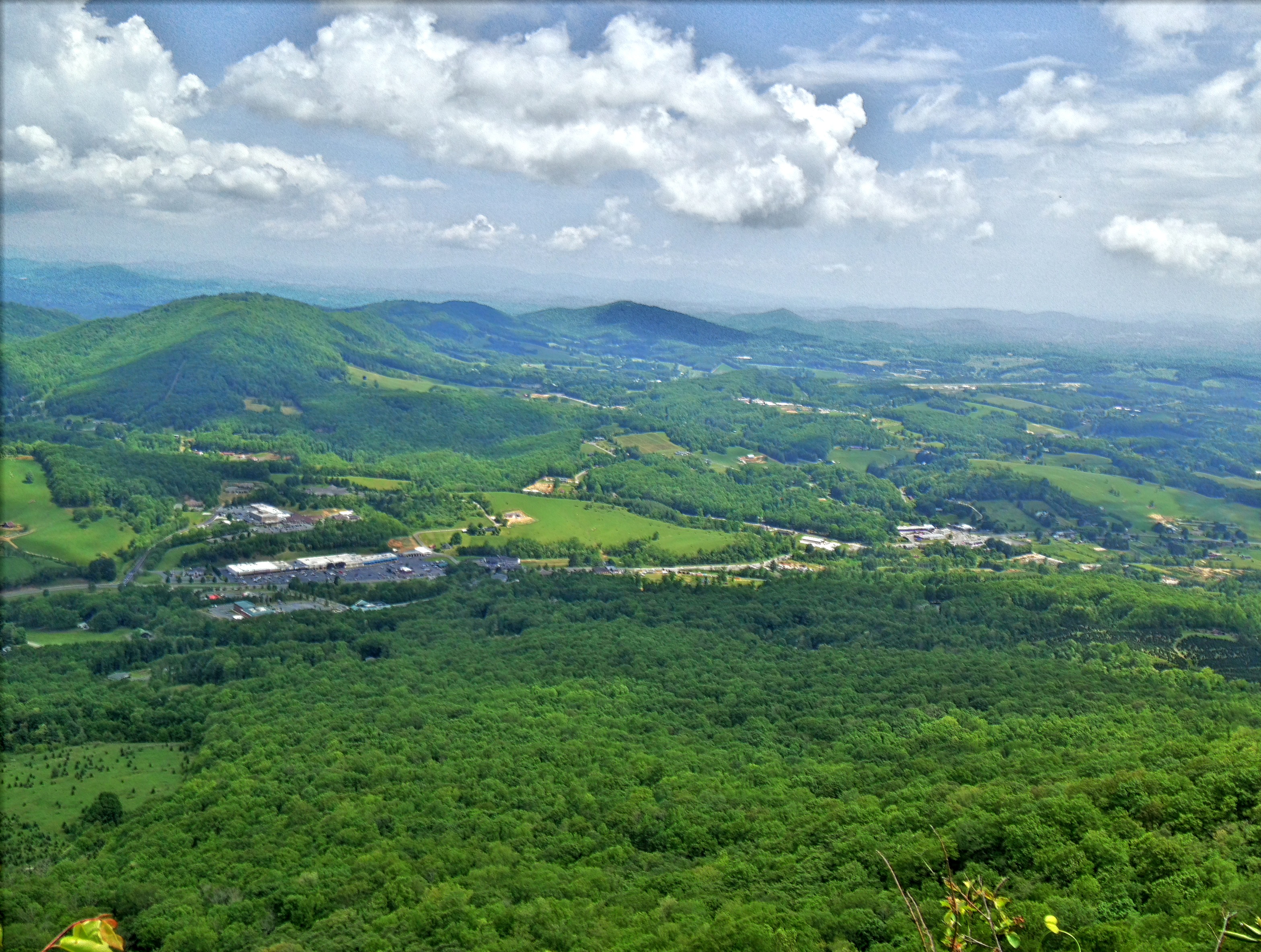
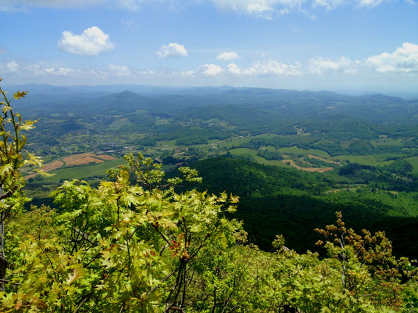
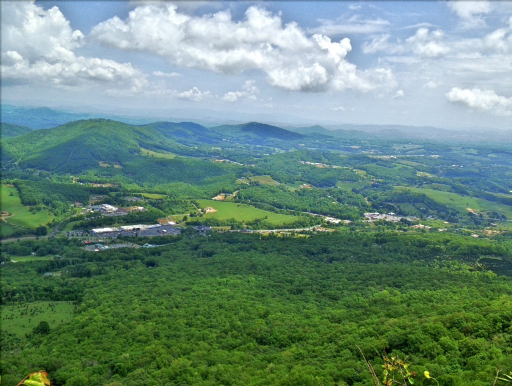
Mount Jefferson State Park Hiking Trails is located in West Jefferson North Carolina. The trail takes you from the parking lot where you can have a picnic up to the top of the ridge where the cell tower is and along certain outcroppings of rock where the views are picture perfect and worth a snapshot with the iPhone or camera. The the trail starts to follow its way back down the back side of the ridge and turning around headed back to the parking lot but at a lower elevation. It finally meets up with the main trail you started on going up tot the top of the ridge. This is definitely a great hike during a clear summer day or to see vast fall colors from the surrounding mountains.
Tips:
Make sure when you start up the hill you stop by the bathrooms before the hike.
If you decide to do all three hikes it takes a about an hour.
Mount Jefferson State Park trail Map
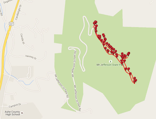
Photo Gallery
*Click on thumbnails for larger viewing and slideshow