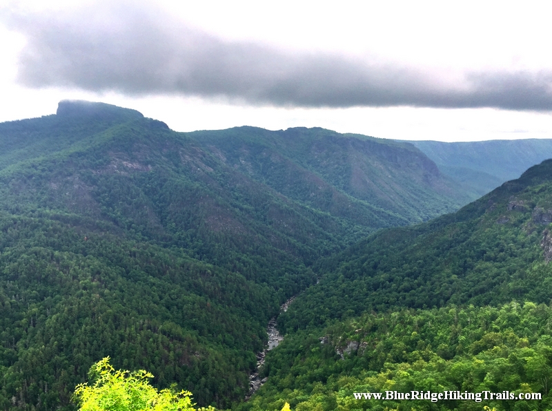
Hiking Humpback Rocks is a relatively short hike following a 2.0-mile (3.2 km) trail loop. With a roughly 45-minute hike to ascend 740 feet (230 m) to the peak, and a 20-25-minute descent, this ranks as one of the shorter hikes along the Blue Ridge, however it remains one of the most rewarding. The peak affords a spectacular 360-degree view of the surrounding terrain. To the north you can see into the southern section of Shenandoah National Park, to the east check out the patchwork of farms, to the southwest you see thick woods and mountain ridges of the George Washington National Forest.
Hikers may continue to follow the Trail for .5 miles (0.80 km), passing along the top of a cliff with views to the south and east before descending 1.2 miles (1.9 km) to a blue blaze trail. This trail leads .3 miles (0.48 km) into the Humpback Rocks Picnic Area. The distance between Humpback Gap and the Humpback Rocks Picnic Area is 3.6 miles (5.8 km). A map of the hike and of the Humpback Gap Overlook is available through the Blue Ridge Parkway website.
Continuing past Humpback Rocks itself, the summit of Humpback Mountain is only a few minutes further. The Appalachian Trail is only a short hike to the north, at milepost 6.
The Humpback Rocks Visitors Center is located at milepost 5.8, six miles south of the Rockfish Gap Interchange of I-64 and US 250. It is most easily accessed by either one of these two highways. Head south on the Blue Ridge Parkway for 5.8 miles (9.3 km) to reach the Humpback Rocks Visitors Center, or continue another 0.2 miles (0.32 km) to arrive at the Humpback Gap parking area on the left.
The Appalachian Trail can also be accessed from the Humpback Gap parking area. Southbound hikers can reach it by continuing south on the Humpback Rocks trail. Northbound hikers can reach it taking the one mile (1.6 km) blue blazed path at the northern end of the parking lot, or the one mile (1.6 km) white blazed path just off of the Howardsville Turnpike.
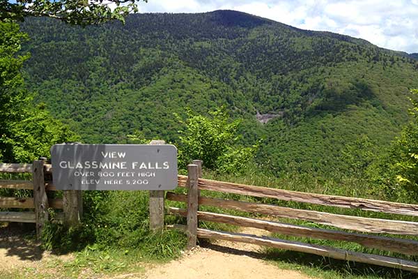
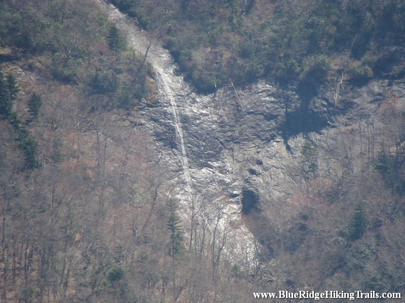
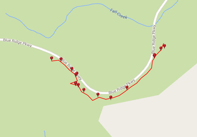
Trail head: Milepost 361.2 Blue Ridge Parkway
Distance: 0.1 miles Duration: 1 minutes Skill Level: Easy
Overview: When you park at the Blue Ridge Parkway overlook. Get out of the car and walk up the little hill on the path. Once you get to the top you will see the waterfall across the valley on the far side of the overlook.
Tips:
Need Binoculars to see waterfall up close
Photo Gallery
*Click on thumbnails for larger viewing and slideshow
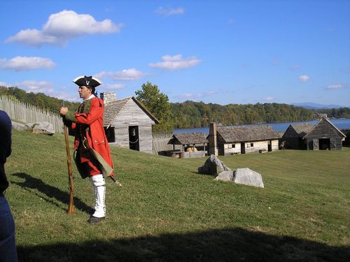
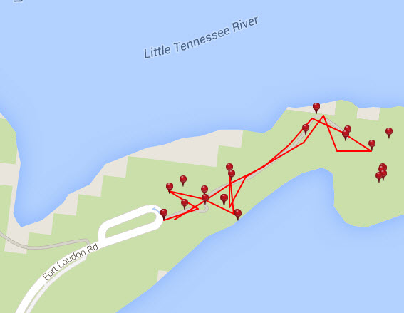
Trail head: Fort Loudon, Tennessee
Distance: 0.6 miles Duration: 31 minutes Skill Level: Easy
Overview: On one of my sales trips I wanted to go on a hike and the locals told me to check out Fort Loudon in Tennessee. Being a history buff and seeing many forts across the east coast growing up. I went to go hike the trail.
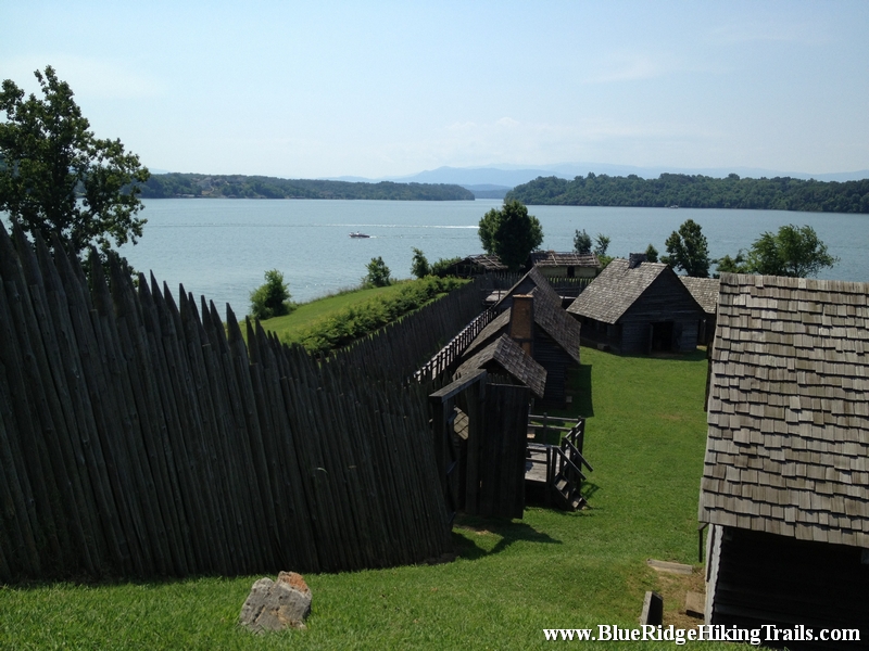
Fort Loudoun was a British colonial-era fort located in what is now Monroe County, Tennessee, United States. Built in 1756 and 1757 to help garner Cherokee support for the British at the outset of the Seven Years’ War, the fort was one of the first significant British outposts west of the Appalachian Mountains.
Fort Loudoun State Historic Park is 1,200-acres and is one of the earliest British fortifications on the western frontier, built in 1756. The fort was reconstructed during the Great Depression and was designated a National Historic Landmark in 1965.
During the French and Indian War (1754-1763) the British Colony of South Carolina felt threatened by French activities in the Mississippi Valley. To counter this threat, the Colony sent the Independent Company of South Carolina to construct and garrison what became Fort Loudoun. This move helped to ally the Overhill Cherokee Nation in the fight against the French and guaranteed the trade would continue between the Cherokee and South Carolina.
In the course of the fort’s four year existence, relations between South Carolina and the Cherokee Nation broke down. In August 1760, the Cherokee captured Fort Loudoun and its garrison. After the surrender in 1760, Fort Loudoun was never used again for any military purpose. It is thought the Cherokees destroyed the fort sometime shortly after the English marched away.
Nature reclaimed the site and there was no public recognition of the Fort until 1917. In November of that year the Colonial Dames of America placed a commemorative marker at the Fort Loudoun site. In 1933, the Tennessee General Assembly purchased the site of Fort Loudoun and created the Fort Loudoun Association to manage it. The Fort Loudoun Association ran the site for nearly 45 years until it became a Tennessee State Park in 1977.
Today, the reconstructed fort and the ruins of the 1794 Tellico Blockhouse overlook TVA’s Tellico Reservoir and the Appalachian Mountains.
Fort Loudoun State Park’s interpretative center offers information on the area’s history and artifacts that were excavated prior to the Fort’s reconstruction from the French and Indian War. There is an auditorium that features The Fort Loudoun Story, a 30 minute video about the history of the site.
Along with living history and monthly interpretive programs, the park hosts several popular seasonal events such as, the 18th Century Trade Faire in September and Christmas at Fort Loudoun which provide a living history of the fort.
For more information, please contact Fort Loudoun State Park directly at 423-884-6217.
Tips:
Water Bottle
Bring Camera
Regular shoes
Family oriented
Fort Loudon TN Trail Map
Photo Gallery
*Click on thumbnails for larger viewing and slideshow
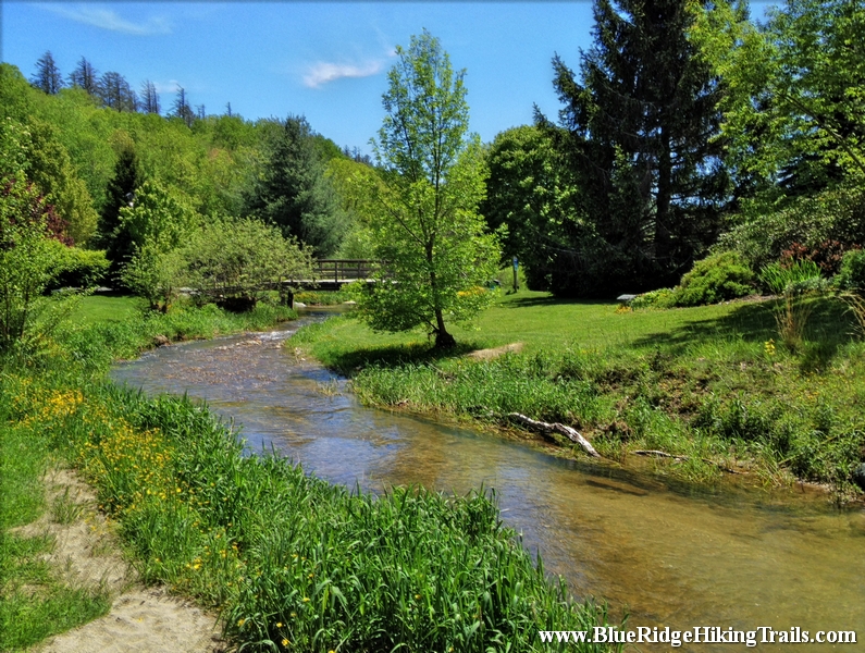
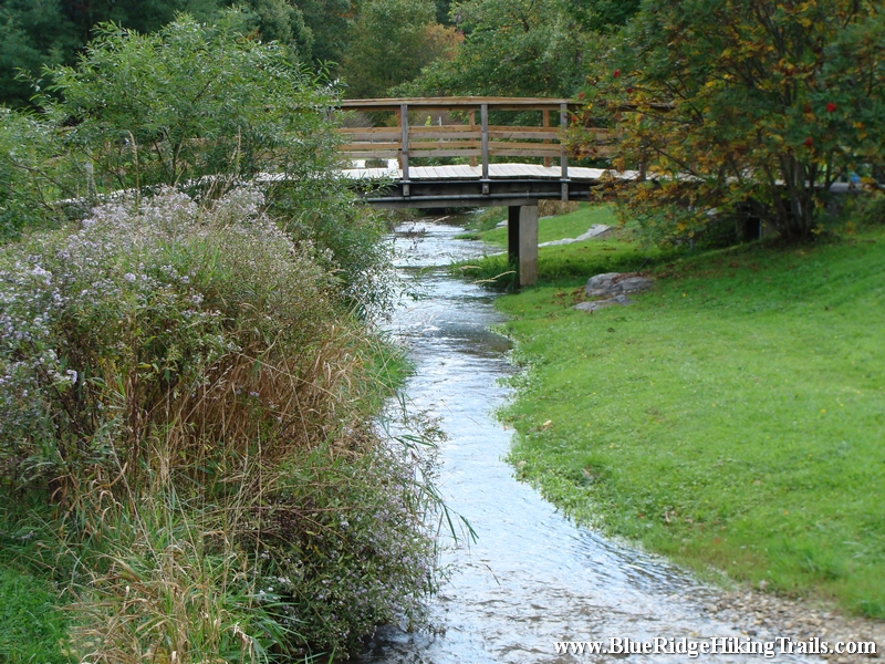
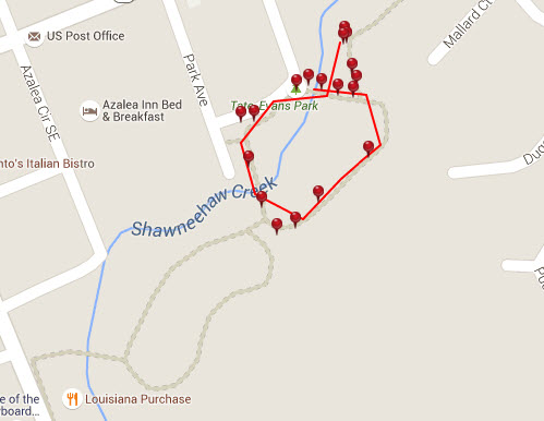
Trail head: Banner Elk, North Carolina
Distance: 0.3 miles Duration: 7 minutes
Skill Level: Easy
Overview:
Tate Evans Park located next to town hall in Banner Elk North Carolina is one of the most relaxing parks I have ever been to and has everything for everyone, making it an ideal place to go visit. If you have children they can play in the creek when warmer, use the 2 different playgrounds, swings, ride their bikes around the loop, play volleyball, have a picnic, or walk the dog. There is even shelters and grills for barbecues, along with two separate bathrooms. The park is used for many great events in town such as the Fourth of July, Christmas tree lighting, Thursday summer concerts, and more.
Tips:
Dog park, dog friendly
Bathrooms, Picnic Benches, Grill, Shelters
Regular shoes or sneakers would be fine for this hike
Would recommend this hike to families with small kids
Great spot for kids to play on the playground, ride bikes, have picnic, play in the creek
Tate Evans Park Trail Map
Photo Gallery
*Click on thumbnails for larger viewing and slideshow
Trail head: Milepost 273 Blue Ridge Parkway
Distance: 0.7 miles Duration: 20 minutes
Skill Level: Easy / Moderate Hiking Trail
Overview:
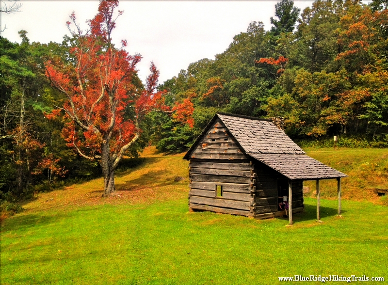
Tomkins Knob Hiking Trail is a good extra hike to add onto the Cascades Falls Trail at EB Jeffress Park on the Blue Ridge Parkway. This adds another .7 miles to the .9 mile waterfall loop. This was a good leg stretcher, very flat through the woods until you get to the beginning of the cascades trail. On the the trail you will enter a field where there is a very old mountain cabin that you can walk through and see how people lived in the mountains long ago.
Tips:
Water bottle
Regular shoes or sneakers would be fine for this hike
Would recommend this hike to families with small kids