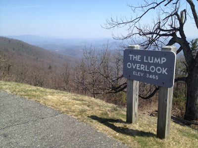
Trail head: Walsh, North Carolina Distance: 0.2 miles Duration: 9 minutes Skill Level: Easy Overview: The Lump Trail is located at milepost 264.4 off the Blue Ridge Parkway. The Lump Trail is an extremely short hike up the adjacent hill behind the fence and is 0.3...
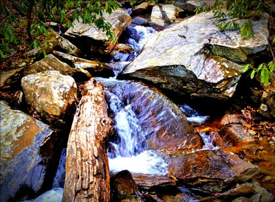
Trail head: Milepost 299 Blue Ridge Parkway Distance: 2.1 miles Duration: 2 hrs Skill Level: Very Strenous Overview: Gully Creek Trail starts at the Blue Ridge Visitor Center, Cumberland Knob, at milepost 217.5 off the Blue Ridge Parkway. Go past the visitor...
Trail head: Walsh, North Carolina Distance: 0.2 miles Duration: 9 minutes Skill Level: Easy Overview: The Lump Trail is located at milepost 264.4 off the Blue Ridge Parkway. The Lump Trail is an extremely short hike up the adjacent hill behind the fence and is 0.3...
Trail head: Milepost 299 Blue Ridge Parkway Distance: 2.1 miles Duration: 2 hrs Skill Level: Very Strenous Overview: Gully Creek Trail starts at the Blue Ridge Visitor Center, Cumberland Knob, at milepost 217.5 off the Blue Ridge Parkway. Go past the visitor...
Milepost 422.4
Distance: 1.0 mile out and back from the parking area.
Difficulty: Strenuous
Elevation Gain : 258 feet Trailhead: Blue Ridge Parkway milepost 422.4, park at the Devil’s Courthouse Overlook
Elevation: 5720′
Tips:
This is a family friendly hike for children over 5. It is a very steep incline for adults.
Sneakers or hiking shoes
Definitely bring a camera or video camcorder the views are like a painting.
Park you car at the overlook. When looking up at the rock face sometimes you can see some tiny hikers at the top viewing area. Follow the paved pathway parallel with the Blue Ridge Parkway towards the tunnel and enter the woods. Get ready to climb almost straight up at a very steep incline. There is a bench in the left half way up. Then the pathway turns to a wall enclosed viewing area with spectacular mountain views. Looking to the East is the Carolina Piedmont. The view to the West is the Shining Rock Wilderness
Overview: This is a very family walking trail in Blowing Rock North Carolina. It is part of the Moses Cone Memorial Park Trail system. The hike is about one mile in length but is a beautiful walk around the lake during any season. This hiking trail is a great stretch your legs type of hike after you have been driving in the car all day. Pets are welcomed on this trail but must be on a leash. I would definitely recommend this hike during the fall season for a brisk walk and great picture taking.
Tips:
Make sure you have comfortable hiking shoes
You must sign your name to the Grandfather Mountain List for the Ranger
Bring plenty of water at least 2 bottles and a back pack
Bass Lake Loop Trail Map
Photo Gallery
*Click on thumbnails for larger viewing and slideshow
Video View From Flat Rock View on Grandfather Mountain