by admin | May 11, 2015 | Campground Hiking Trails, Hiking By Activity, Hiking By Difficulty, Hiking By Distance, Hiking National Parks, Hiking Trails - Over 1.0 Mile, Hiking Trails Blue Ridge Parkway NC, Moderate Hiking Trails, North Carolina Campground Trails, North Carolina Overlook Mountain Trails, North Carolina Waterfall Trails, Overlook Hiking Trails, Waterfall Hiking Trails
Trail head: Blue Ridge Parkway-Milepost 295.9
Distance: 2 miles
Duration: 1 hour
Skill Level: Moderate Hiking Trails
Overview:
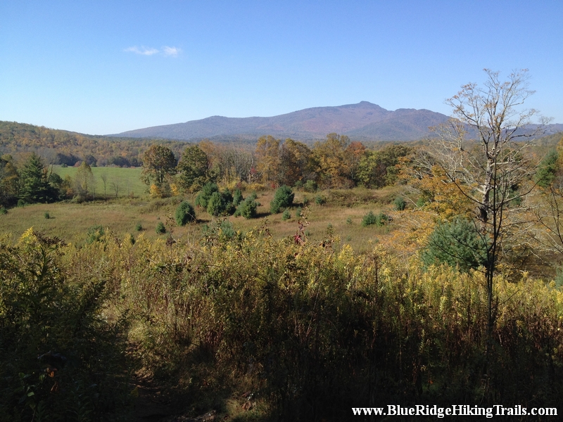
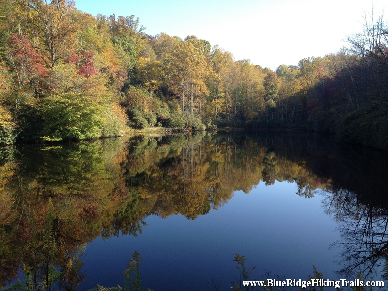
Drive to the Blue Ridge Parkway to milepost 295.9 and park in the overlook. There is a small lake called Sims Pond, and waterfall here and a map of the green knob and which is part of the Julian Price memorial park trail system. After crossing the bridge over the waterfall, continue around the pond on the trail. The trail crosses and runs along the creek then starts to ascend the mountain, the path then go under the blue ridge parkway bridge at Sims Creek Overlook. The trail continues along the creek and climbs the mountain until you reach the green pasture. Then continue up the road and follow the stone arrow signs. The trail heads back into the woods and downwards back in to a field with a mountain view. The trail then continues to loop around and ends up back at the road across from the overlook and the Sims Pond.
Tips:
- Hiking Shoes and Water bottle
- Intermediate hike for families with small kids
Green Knob Trail Map
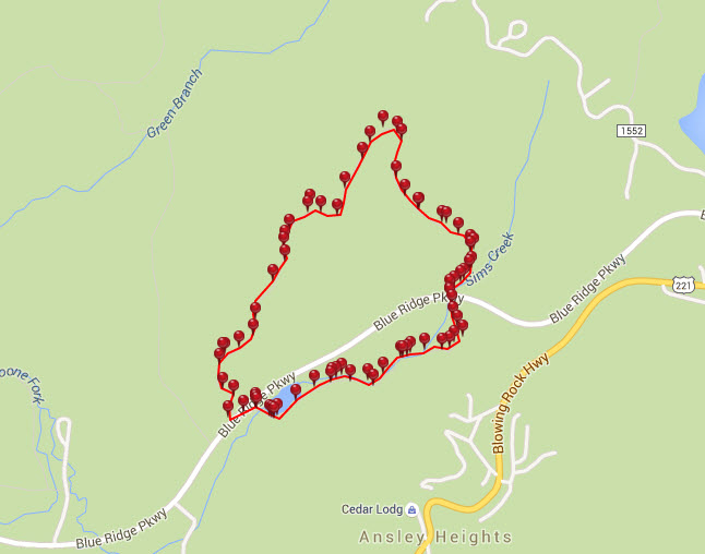
Photo Gallery
*Click on thumbnails for larger viewing and slideshow

by admin | Apr 20, 2015 | Hiking By Difficulty, Hiking By Distance, Hiking Trail Guides by State, Hiking Trails - Over 1.0 Mile, Moderate Hiking Trails, North Carolina Mountain Hiking Trails, North Carolina Overlook Mountain Trails, Overlook Hiking Trails
Lover’s Leap Trail Hike located in Hot Springs, NC is part of the Appalachian Trail and a 1.6 mile loop. From the Silvermine Trailhead walk down the road and get on the Appalachian Trail (white blazes) along the French Broad River. After about 0.5 mile the trail climbs steeply to Lover’s Leap ridge. When this trail reaches the ridge, there are rock outcrops with numerous overlooks.Panoramic views of the French Broad River and town of Hot Springs make this trail one of the best in Madison County. Return on the Lover’s Leap Trail (blue blazes) and descend to the trailhead.
The old legend says a beautiful Cherokee maid was deeply in love when another Indian brave challenged her lover for her hand. They fought and her lover died in the fight. In total heartbreak (and rather than marry the victor) she climbed to the rocky ledge that overhangs the French Broad River and jumped to her death; thus the name “Lover’s Leap.”
*Click on thumbnails for larger viewing and slideshow
by admin | Feb 18, 2014 | Easy/Moderate Hiking Trails, Hiking By Difficulty, Hiking By Distance, Hiking Trails - Over 1.0 Mile, North Carolina State Park Trails, State Park Hiking Trails
Trail head: West Jefferson, North Carolina
Distance: 1.7 miles
Duration: 1 hour
Skill Level: Easy/Moderate Hiking Trails
Overview:
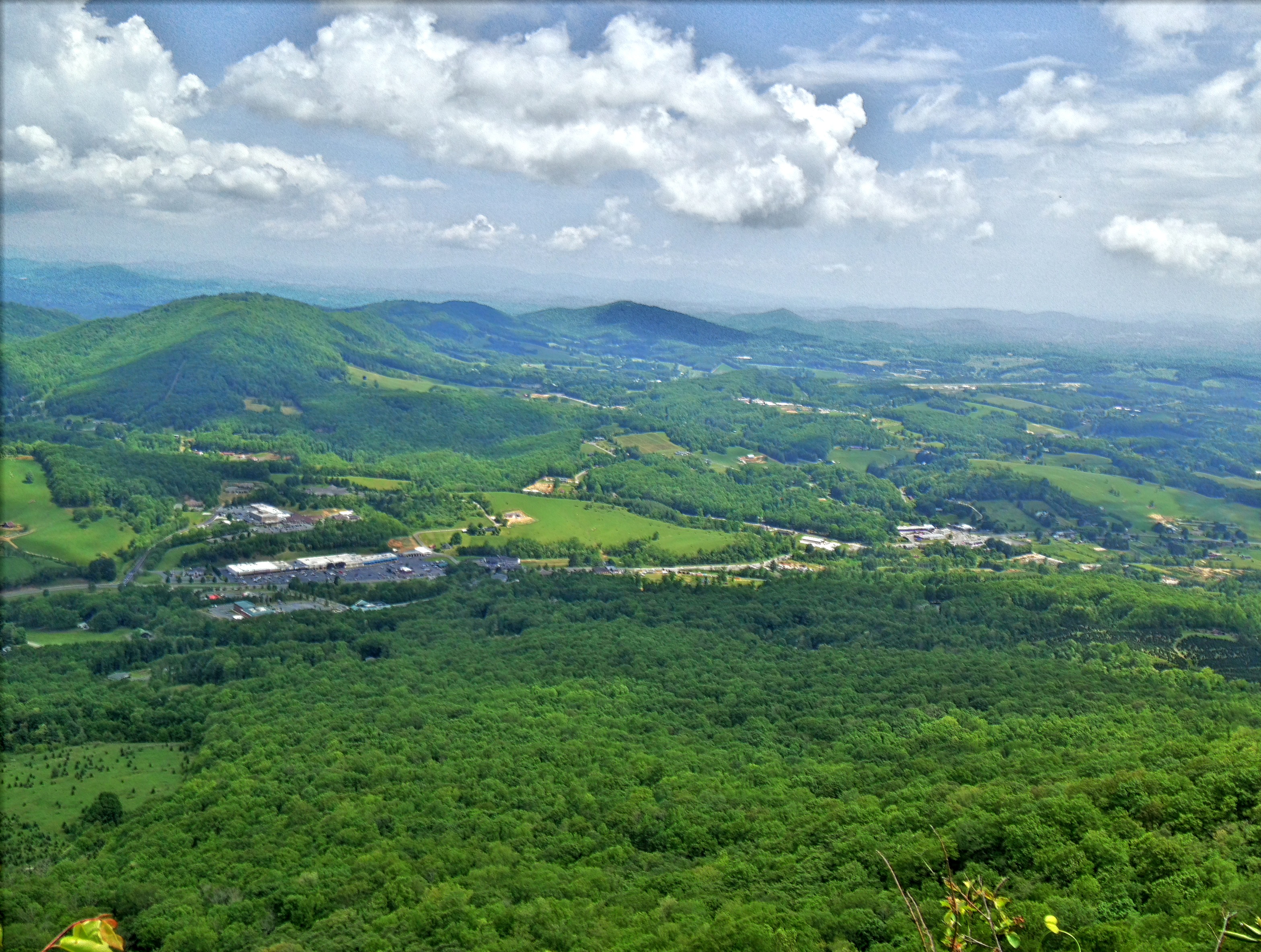
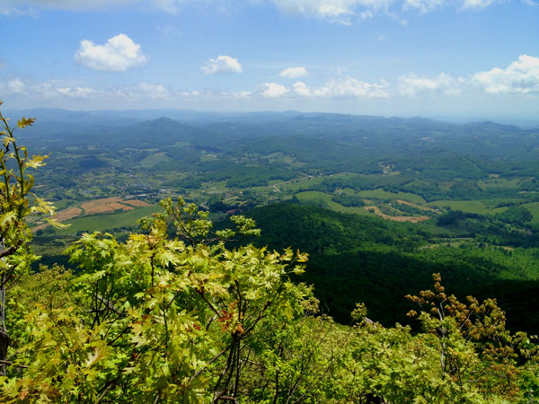
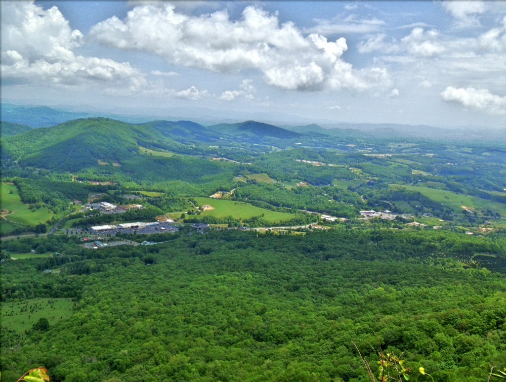
Mount Jefferson State Park Hiking Trails is located in West Jefferson North Carolina. The trail takes you from the parking lot where you can have a picnic up to the top of the ridge where the cell tower is and along certain outcroppings of rock where the views are picture perfect and worth a snapshot with the iPhone or camera. The the trail starts to follow its way back down the back side of the ridge and turning around headed back to the parking lot but at a lower elevation. It finally meets up with the main trail you started on going up tot the top of the ridge. This is definitely a great hike during a clear summer day or to see vast fall colors from the surrounding mountains.
Tips:
Make sure when you start up the hill you stop by the bathrooms before the hike.
If you decide to do all three hikes it takes a about an hour.
Mount Jefferson State Park trail Map
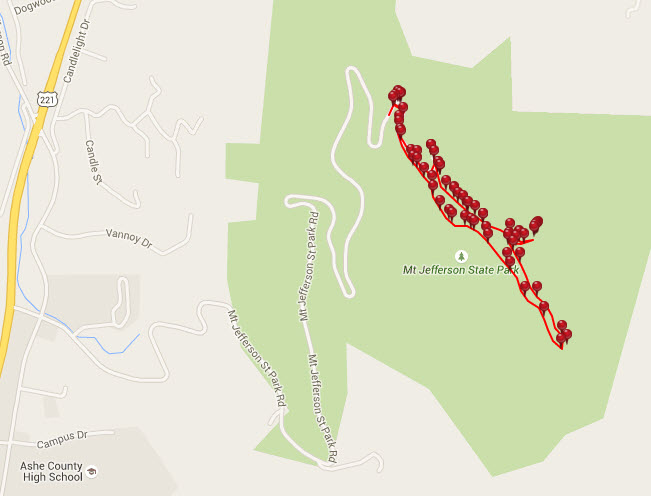
Photo Gallery
*Click on thumbnails for larger viewing and slideshow