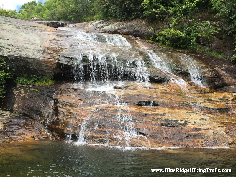
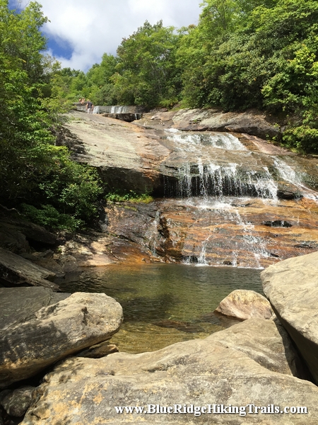
Graveyard Fields Waterfalls-Blue Ridge Parkway-Milepost 418

Trail Head: Julian Price Picnic Area
Distance: 4.9 miles
Duration: 2.5 hrs
Skill Level: Moderate /Strenuous
Overview:
Tips:
Boone Fork Trail Map:
Photo Gallery
*Click on thumbnails for larger viewing and slideshow
Trail Head:
Distance:
Duration:
Skill Level:
Overview:
Tips:
Map:
Photo Gallery
*Click on thumbnails for larger viewing and slideshow
Trail head: Milepost 296.7 Blue Ridge Parkway
Distance: 2 miles
Duration: 56 minutes
Skill Level: Moderate Hiking Trails
Overview:
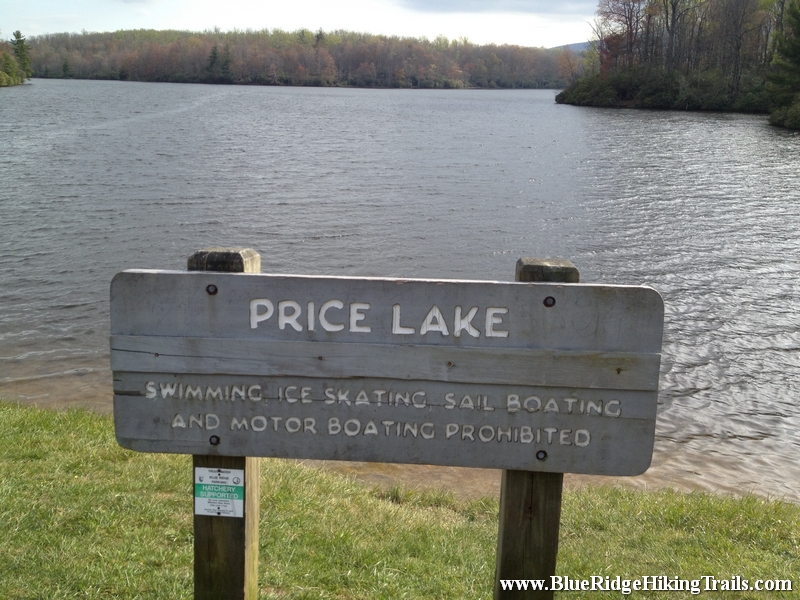
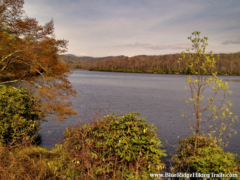
The Price Lake loop trail is part of the Julian Price memorial park trails. From the Parking lot at the front of the lake at milepost 296.7.We went left around the lake and followed the path through the rhododendrons as we passed many opening with different views of the lake. We saw people fishing, canoeing, and sitting on benches enjoying the sounds and breeze of the lake. The trail winds around sometimes very close to the shore of the lake and you will have to cross many small and large bridges on the trail. We even got to see beavers and the dam they built towards the back of the lake. We even passed the boathouse were you can rent canoes and kayak for an adventure on the lake. The lake is at an elevation of 3410 feet. Continue past the campground entrance and you will end of back at the parking lot where you started. Price Lake is a wonderful hike and is worth a first or second trip during the fall foliage.
Tips:
Price Lake Loop Trail Map
Photo Gallery
*Click on thumbnails for larger viewing and slideshow

Trail head: Milepost 316.4 Blue Ridge Parkway
Distance: 1.9 miles
Duration: 25 minutes
Skill Level: Strenuous Hiking Trails
Overview:
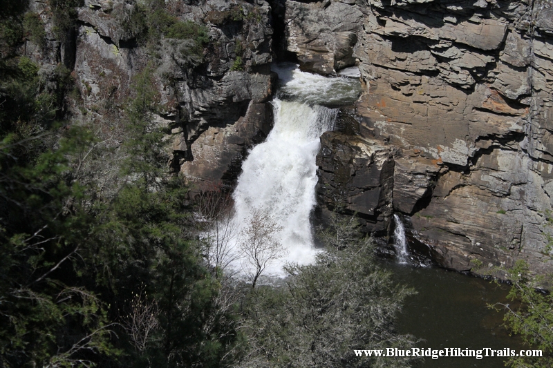
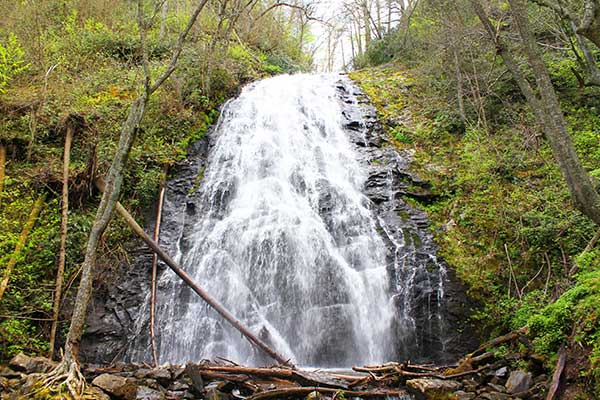
Linville Falls is one of the major attractions along the Blue Ridge Parkway at milepost 316. Linville falls is located in the Blue Ridge mountains of North Carolina and is the beginning of Linville Gorge; the waterfalls are fed from the Linville River and flows down the mountain into Lake James near Marion, North Carolina.
There are two main trails to see the Linville Falls and upper trail and lower trail. This trip we took the upper trail Erwin’s View Trail and is approximately 0.8 miles; 1.6 miles round trip taking 45 minutes to 1hr and 30 minutes. Starting from the Linville Falls Visitor Center the 0.5 mile hike takes you to an overlook where visitors can see the two upper falls and the rushing water as it carves out the rock falling 150ft to the main waterfall. The Erwin’s View trail leads to 2 more overlooks, the Chimney overlook (0.7 miles) and Erwin’s View overlook (0.8 miles).Each overlook has a great view of the waterfalls and the Linville Gorge and a picture is well worth a thousand words once you reach the overlooks.
Tips:
Linville Falls Trail Map
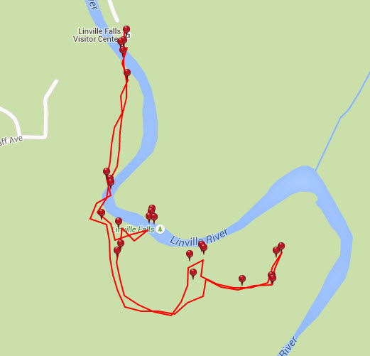
Photo Gallery
*Click on thumbnails for larger viewing and slideshow
Trail head: Milepost 339.5 Blue Ridge Parkway
Distance: 2.6 miles
Duration: 2 hrs
Skill Level: Moderate/Strenuous Hiking Trails
Overview:
Tips:
Crabtree Falls Loop Trail Map
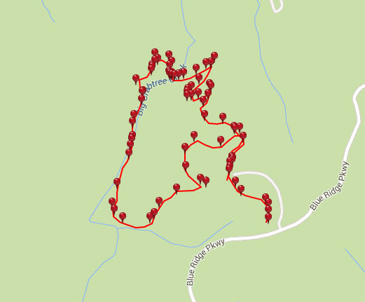
Photo Gallery
*Click on thumbnails for larger viewing and slideshow