Glassmine Falls-Blue Ridge Parkway-Milepost 361.2

Glassmine Falls-Blue Ridge Parkway-Milepost 361.2

Glassmine Falls 7


Trail head: Milepost 361.2 Blue Ridge Parkway
Distance:
0.1 miles
Duration: 1 minutes
Skill Level: Easy


Overview:
When you park at the Blue Ridge Parkway overlook. Get out of the car and walk up the little hill on the path. Once you get to the top you will see the waterfall across the valley on the far side of the overlook.


Tips:

  • Need Binoculars to see waterfall up close

Photo Gallery

*Click on thumbnails for larger viewing and slideshow

Craggy Gardens & Pinnacle-Blue Ridge Parkway-Milepost 364

Craggy Gardens & Pinnacle-Blue Ridge Parkway-Milepost 364

BRHT42


Trail head: Milepost 364 Blue Ridge Parkway
Distance:
0.9 miles
Duration: 60 minutes
Skill Level: Moderate Hiking Trail


Overview:
Craggy Gardens and Craggy Pinnacle Trail is one of the most beautiful trails to hike on the Blue Ridge Parkway when the Rhododendrons are blooming forming a canopy of magenta and purple color against the greenery and the Blue Ridge Mountains.

Craggy Gardens is located on milepost 364 on the Blue Ridge Parkway and is about 1hr 30 min from Banner Elk North Carolina.

Your trail hike starts in the parking lot…we parked in the lower parking lot showing you a magnificent  180 degree panoramic video of the Blue Ridge mountains. Then continue to the upper parking lot where you will see the parkway sign “Craggy Dome” the trail head is just on the other side indicated by a sign. The first part of the trail is covered by color as the plants create a canopy in which you walk under on the trail. The first part of the journey is a gradual climb; then you reach a bend and a nice elevated rock with a view.

The trail then leans more upward until it reaches a fork to the right where there is a plateau and many scenic overlooks. As you loop back around the trail with a sign states left to the upper lookout and right to the lower lookout. The lower lookout just allows you to see the visitor center and the mountains in the distance about a 180 degree view. If you want to feel like you are on top of the world take the upper lookout trail until you reach the rock wall with stairs. As you emerge from the stairs you will see a 360 degree lookout with a beautiful scenic landscape of the Blue Ridge mountains, the Asheville watershed lake, and more.

What goes up must come down as the walk down the mountain trail is a lot more easier than going up.


Tips:

  • Great Mountain Views
  • Family friendly trail
  • Moderate Hiking Trails
  • Hiking shoes or sneakers
  • Camera or video recorder
  • Bottle of water
  • Plan the hike on a nice sunny day

Craggy Gardens Trail Map
craggy pinnacle


Photo Gallery

*Click on thumbnails for larger viewing and slideshow

Mount Mitchell Lookout Tower-Blue Ridge Parkway-Milepost 355.4

Mount Mitchell Lookout Tower-Blue Ridge Parkway-Milepost 355.4

Mount Mitchell 12


Trail head: Milepost 355.4 Blue Ridge Parkway
Distance:
0.5 miles
Duration: 6 minutes
Skill Level: Moderate / Strenuous


Overview:

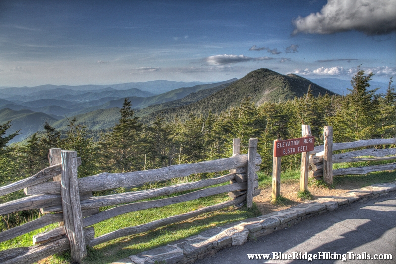
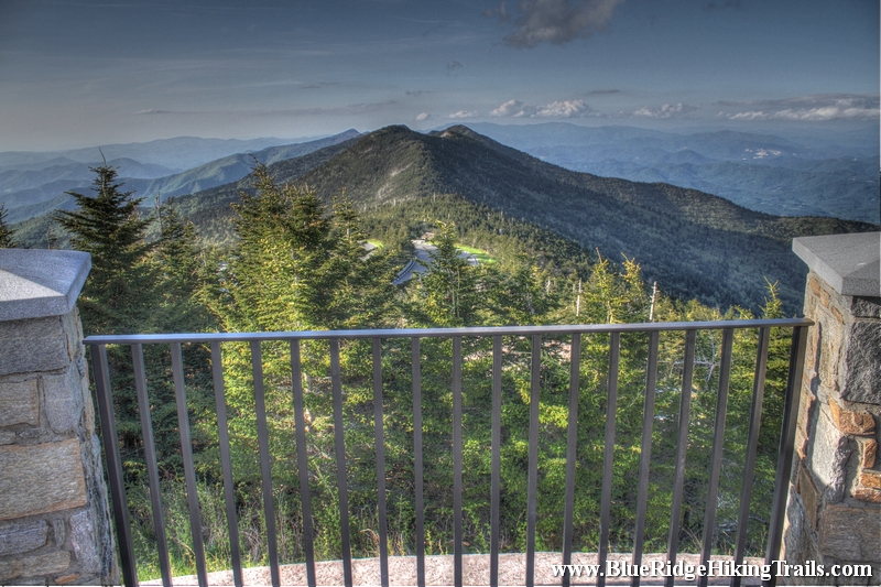
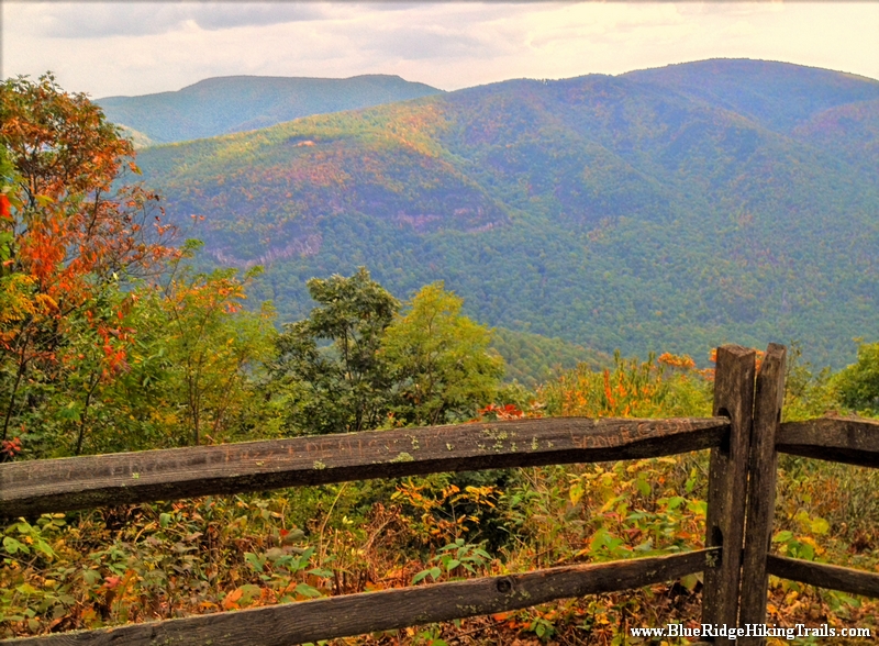
Lofty Mount Mitchell, near Burnsville, North Carolina, rises to an elevation of 6,684 feet and is the highest mountain east of the Mississippi River. The mountain is the centerpiece of the 1,946-acre Mount Mitchell State Park, which is easily accessible off the Blue Ridge Parkway.

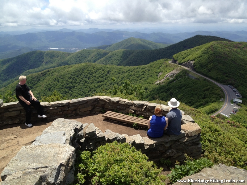
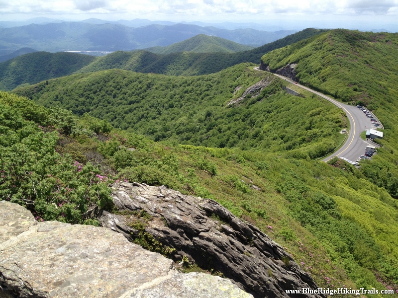
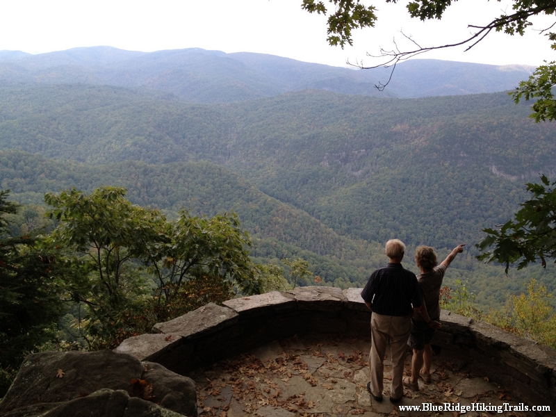
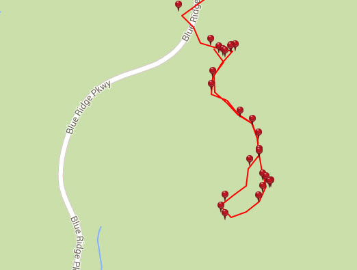
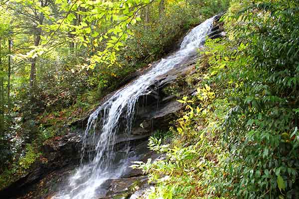
Mount Mitchell State Park offers numerous hiking trails as well as a museum, restaurant, concession stand and gift shop. A new observation deck, accessible by wheelchair, offers breathtaking panoramic views.

Mount Mitchell State Park contains extensive spruce-fir forest, an ecosystem that is common in northern climes, but which is only found in a narrow band in the Appalachian Mountains. This natural community is characterized by evergreens, particularly red spruce and Fraser fir.

Some of the uncommon animals that inhabit Mount Mitchell are the endangered northern flying squirrel, New England cottontail, bobcat, and many species of salamanders. Some of the birds that breed here are more typical of northern conifer forests: red-breasted nuthatch, brown creeper, and golden-crowned kinglet.

Long before it was a State Park, Mount Mitchell was a popular tourist destination. In the 1920s, after the logging operations ceased on the mountain, the former logging railroad from the nearby town of Black Mountain was converted into a tourist train. Three years later, the rails were removed, and the rail bed became a motor toll road. For more than a decade, tourists visited the area along this route, until the construction of the Blue Ridge Parkway put the toll road out of business.

The mountain was named in honor of Dr. Elisha Mitchell, an educator and scientist from Chapel Hill, who died while climbing the mountain in 1857 in his effort to prove it was the highest peak in eastern North America. The grave of Dr Mitchell lies next to the observation deck.

Click on the link below to hear more in a Living Traditions Moment


Hours of Operation

Park hours are:

November – February 8 am – 6 pm
March – April 8 am – 8 pm
May – August 8 am – 9 pm
September – October 8am – 8 pm

During the winter months, the Park is often inaccessible from the Parkway due to snow and ice. The Park is closed on Christmas Day.

Park office hours are 8 am – 5 pm daily. In the winter months, the office is closed on weekends.


Admission Fees

There is no fee to enter the Park, but there is a charge for campsites.

Picnic shelters are offered for free on a first-come, first-served basis, but can be reserved in advance for $33 a day.

Hours of operation and fees are subject to change. Contact directly for most current information.


Location

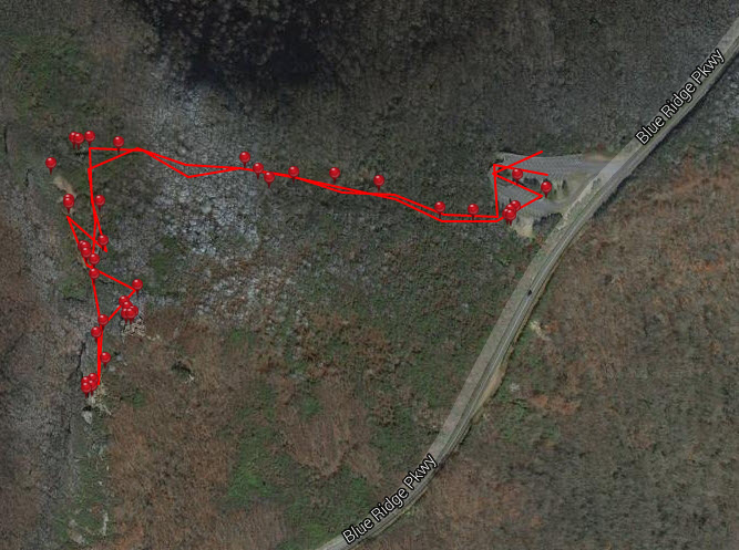
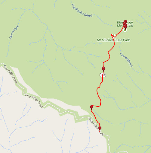
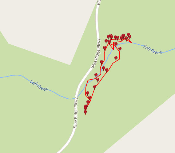
Mount Mitchell State Park is located off the Blue Ridge Parkway. At milepost 355.4, turn north on NC 128 and go 2.4 miles to the Park entrance.

Mount Mitchell State Park
2388 State Highway 128
Burnsville, NC 28714
(828) 675-4611


Tips:

  • Safe place to let the kids out to run around around.
  • Great spot for a picnic or something to drink.
  • Do not need any hiking shoes for this walk.
  • Bring the Camera for mountain view photos, 360 degree views

Mount Mitchell Lookout Tower Trail Map
mount mitchell lookout tower


Photo Gallery

*Click on thumbnails for larger viewing and slideshow

Figure 8 Loop Trail-Moses Cone Memorial Park-Blue Ridge Parkway

Figure 8 Loop Trail-Moses Cone Memorial Park-Blue Ridge Parkway

Figure 8 Trail Moses Cone 17


Trail head: Milepost 293-295 Blue Ridge Parkway
Distance:
0.4 miles
Duration: 12 minutes
Skill Level: Easy

Overview:
Arrive at Mose Cone Memorial Park on the Blue Ridge Parkway. Head down the stairs to the parkway craft center. Go past the Moses Cone home on the right and you will see the figure eight trail sign. This is a good leg stretcher that is easy for weary travelers who have been on the parkway for a while in the car and need to get the blood moving and wake up a bit. the trail is a figure eight loop trail that has many signs about the types of trees around the Moses Cone Manor Memorial Park. There are 25 miles of trails at Moses Cone Park please see the following:
Rich Mountain Carriage Trail
Bass Lake Loop Trail
Flat Top Tower Trail
Moses Cone Carriage Trails

Tips:
  • Water bottle
  • Regular shoes or sneakers would be fine for this hike
  • Would recommend this hike to families with small kids

Figure 8 Loop Trail Map
figure 8 loop trail


Photo Gallery

*Click on thumbnails for larger viewing and slideshow

Chestoa View Trail-Blue Ridge Parkway-Milepost 320

Chestoa View Trail-Blue Ridge Parkway-Milepost 320

BRHT24


Trail head: Milepost 320 Blue Ridge Parkway
Distance:
0.6 miles
Duration: 46 minutes
Skill Level: Easy

Overview:
On the Blue Ridge Parkway  at milepost 320 you will see a sign for Chestoa View Parking. Get out park your car, and you will see the trail head in front of you. Follow the paved path for a few minutes until you reach the concrete steps downwards until your reach the overlook with mountain views. After seeing the view and walking back up the steps, the trail continues to the left and makes a loop through the forest and back to the parking lot.

Tips:
  • Water bottle
  • Regular shoes or sneakers would be fine for this hike
  • Would recommend this hike to families with small kids

Chestoa View Trail Map
chestoa view trail map


Photo Gallery

*Click on thumbnails for larger viewing and slideshow

Cascades Trail-E.B. Jeffress Park-Blue Ridge Parkway-Milepost 271.9

Cascades Trail-E.B. Jeffress Park-Blue Ridge Parkway-Milepost 271.9

cascades waterfall-blueridgehikingtrails-com


Trail head: Milepost 271.9 Blue Ridge Parkway
Distance:
0.9 miles
Duration: 55 minutes
Skill Level: Moderate Hiking Trail

Overview:
Trail head starts off at the E.B.Jeffress Park overlook at milepost 271.9 on the Blue Ridge Parkway. Past the bathrooms and down the trail the path takes you until you reach a series of steps, the a bridge that crosses Falls Creek which is part of the water for the Cascades waterfall. As you continue down the trail to see and step down many sets of stairs until you come to a stone staircase which leads you to more stairs downwards until you reach the cascades falls. The water fall runs from right to left and is many stories tall. Once you take your photos and head back up a few flights of stairs you then head towards the right and loop around towards the parking lot. there are many picnic benches here for lunch or a snack before or after your hike.

Tips:
  • Water bottle
  • Regular shoes or sneakers would be fine for this hike
  • Would recommend this hike to families with small kids

Cascades Trail Map
cascades falls


Photo Gallery

*Click on thumbnails for larger viewing and slideshow


Directions To The Cascades Waterfall